 Croatia Waterfalls
The krcic waterfall (Krčić slap) is the fall that starts Croatia's most famous waterfall river: the Krčić stream, running out of the Dinara foothills above Knin, throws itself roughly 25 metres off the karst edge into the canyon where the Krka's own source waters gather. It is a seasonal creature — a loud, full curtain after the autumn and spring rains, and a dry limestone ledge by the end of a Dalmatian August — and it costs nothing, sitting at the roadside a few minutes from Knin town. The source logic here is the interesting part: the river effectively gains its main flow where the Krčić falls in, which is why the old maps mark this ledge as the Krka's birthplace. This page covers the fall, the seasonal arithmetic and the headwaters circuit. The river it feeds is covered on the Krka falls guide, the free-falls context on the free waterfalls page, and the country-wide directory on the Croatia Waterfalls homepage.
Quick answer The drop, the seasonality, the free access and the source logic in one read
Checked on 13 September 2026: the Krčić stream drops about 25 m off the karst edge at the mouth of its canyon near Knin, feeding the Krka's headwaters — the spring in the cave below the neighbouring Topoljski fall is the river's documented source, and it can run dry too. The site is free and always open; the waterfall is seasonal, at its best after autumn and spring rains and often dry by late summer. Reach it in about 10-15 minutes by car from Knin; no tours stop here. The river it feeds is on the Krka falls guide, the first barrier downstream on the Bilušića buk page.
Key takeaways
- Free and always open — but the waterfall itself runs seasonally.
- About 25 m of drop where the Krčić stream leaves its canyon and feeds the Krka's headwaters.
- Best after the autumn and spring rains; often a dry ledge by late summer.
- The source logic: the Krka's cave spring at the foot of the neighbouring fall is intermittent — the Krčić brings the reliable flow.
- 10-15 minutes by car from Knin; pair with Knin fortress and the first barrier downstream.
Key facts
Opening hours
| Roadside site, always visible | 00:00–24:00 |
|---|
Closed None — but the fall itself can run dry in late summer; the site is open even when the water is not
Admission
- Adult
- Free — no ticket, no desk; the site sits at the edge of the Krka's protected landscape above the first park barrier
- Reduced
- Free
- Free
- Everyone
Planning it
- Time needed
- 15-30 min
- Address
- Krčić canyon mouth near Knin, Šibenik-Knin County, Croatia
Krčić Waterfall: Free Access and the Nearest Bookable Products
Nothing is sold at the fall; the official rows point to the river's managing authority and the tour rows mark the nearest bookable products for travelers without a car.
The fall is free; the booking question is only what to do with the rest of the day:
| Option | Season / window | Adult price | What it covers | Where it books | Book |
|---|---|---|---|---|---|
| The Krka's managing authority — river and park informationAnyone checking the river's conditions and rules | All year | Free (the fall itself) | River conditions, park rules, the first barrier 16 km downstream | Official site | Official site |
| Krka park price list (2026 PDF)Anyone extending the day into the paid park | Season bands per locality group | Roughly €10-40 peak — confirm on the list | The paid land localities far downstream | Official cjenik | Official site |
| Afternoon tour from Zadar, tickets includedZadar-based visitors without a car | Afternoon departures in season | From ~$75 on the card | The nearest Krka product — it visits the main barrier, not this source fall | Tour card | Check Availability |
| Guided park tour from SplitSplit-based visitors on a region loop | Daily in season | From ~$75 on the card | The nearest bookable regional product — again the paid park | Tour card | Check Availability |
| A dedicated trip for the waterfall aloneAnyone visiting in a dry late-August week | Late summer in drought years | Free but possibly waterless | The ledge can be completely dry; check recent rain or pair the trip with Knin fortress | Skip the dedicated trip — combine with the fortress | Check Availability |
The Fall at the Krka's Head
Where a mountain stream ends, a famous river begins — and the two facts are the same fact.
The Krčić stream gathers in the foothills of the Dinara, the massif whose bulk stands over Knin, and runs through a short, steep canyon of its own before the karst ends the conversation: the stream leaves the canyon mouth over a drop of roughly 25 metres into the pocket where the Krka's headwaters gather. The fall the stream makes here is narrow, single and dramatic in high water — a white plume against grey limestone — and it lands directly in the source country of the river it effectively creates. The published river geography reads it exactly that way: the watercourse that will become the Krka meanders through the Krčić canyon and enters the Knin polje via this waterfall.
The source logic is subtler than the maps suggest. At the foot of the neighbouring fall downstream — the Topoljski slap — a spring rises inside a cave with some 150 metres of mapped passage, and that cave spring is documented as the Krka's source. But the karst gives with one hand and takes with the other: the cave spring is intermittent, sinking and returning with the water table, while the Krčić stream above carries the dependable flow for most of the year — and surrenders it in turn during long droughts, when the ledge runs dry and the young Krka below shrinks to seepage. The practical reading for a visitor: this is where the river is born, and like most births it is seasonal.
The drop, the canyon-mouth geography, the Topoljski cave spring (150 m of passage) and the source framing from the published river geography, checked 13 September 2026.
Seasons, Flow and Finding the Fall
One season rule and one road rule cover the visit.
The season rule first: the fall runs when the karst has water. After the autumn rains (October-November) and through the spring snowmelt from the Dinara foothills, the stream delivers a full curtain; by late summer — August into September in a dry year — the ledge is often completely dry, and the canyon photographs as a geological exhibit instead. The pattern tracks the karst aquifer, not the daily weather: a single July storm will not restart the fall, but a wet week in October will. Anyone planning a dedicated trip should check recent rain around Knin first, and treat the site as a companion stop rather than a destination in the dry weeks.
The road rule: the fall sits at the roadside a few minutes out of Knin, on the local roads that run toward the Krčić village below the fortress hill. Parking is informal at the canyon rim, the viewpoint is a short walk to the edge fence, and the site has no facilities of any kind. Knin itself is the base — fuel, food and the fortress above the town, which doubles as the best overview of the whole headwaters junction. No tours stop here; the nearest bookable products cover the paid park downstream. The headwaters half-day — fortress, fall, and the first barrier 16 km below — is laid out on the road-trip circuit, and the month-by-month guide grades when the karst is most likely to be running.
- Best after autumn and spring rains; often dry August-September in a dry year.
- 10-15 minutes by car from Knin on local roads; informal parking at the canyon rim.
- No facilities — water and shoes from Knin; the rim fence is the viewpoint.
- Knin fortress above town is the overview stop for the whole source country.
- Check recent rain before a dedicated trip — the ledge does not negotiate.
- Do not descend into the canyon below the fall: the walls are loose and the rim is the safe line.
- Pair with the fortress and the first barrier downstream to make the drive earn itself.
Seasonality framing follows the karst hydrology of the headwaters and the published source-country geography, checked 13 September 2026.
The Source Country Stops Compared
The free stops around Knin, compared from the park's locality pages and the published river geography checked on 13 September 2026.
| Stop | Drop | Drive from Knin | Flow reliability | Time on site |
|---|---|---|---|---|
| Krčić waterfall | About 25 m | 10-15 min | Seasonal — strong after rains, often dry late summer | 15-30 min |
| Knin fortress | — (the viewpoint) | In town | — | 45-60 min |
| Bilušića buk (first barrier) | 22.4 m over 300 m | About 20 min | Year-round, full strength | 20-30 min |
| Miljacka slap (middle canyon) | 23.8 m, three large steps | 45-60 min | Strong; hydro-regulated | 20-30 min |
| Manojlovac viewpoint (middle canyon) | Roughly 60 m over steps | 60-75 min | Thins in the warm months | 30-45 min |
Krčić Waterfall Map: the Source Country and the First Barriers
The fall at the canyon mouth, the Knin base and the first barriers of the river it feeds, running downstream.
The Nearest Bookable Tours
No tours stop at this roadside fall — it has no ticket, no desk and no coach logistics. The nearest bookable Krka products are below; they cover the paid park and leave the source country to your own car.
 from $75.18
From Zadar: Krka Waterfalls Afternoon Tour - Tickets Included
Afternoon Krka trip from Zadar with tickets included — built for the quiet late hours.
Check Availability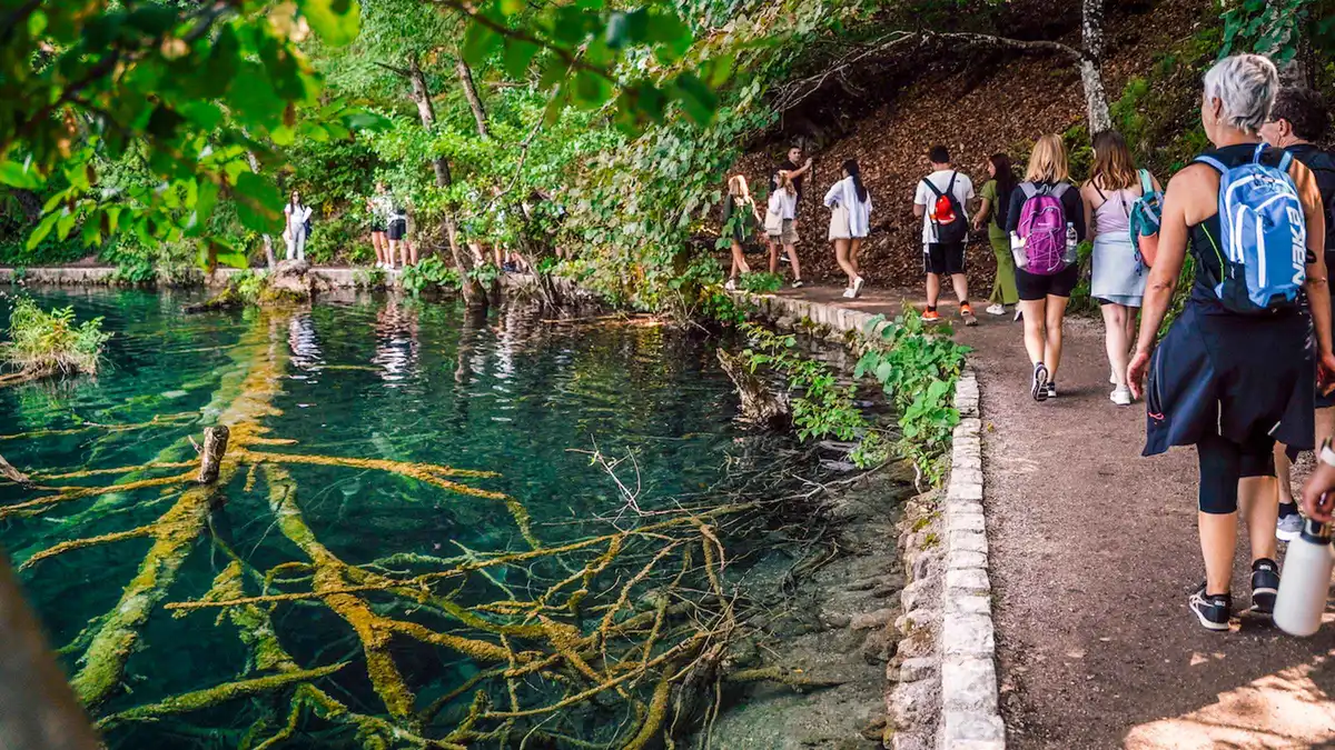 from $75.41
From Split: Plitvice Lakes National Park Guided Tour
Guided Plitvice day tour from Split covering the UNESCO lake terraces with hotel-zone pickup.
Check AvailabilityPrices, ratings and details are the platform's own, checked in Q3 2026; dollar figures are the listed prices — the platform bills in your account's currency.
Is the Krčić waterfall free to visit?
Yes — no ticket, no desk, informal roadside parking a few minutes from Knin. It sits in the river's protected headwater landscape above the first park barrier. The country-wide free list sits on the free waterfalls page.
When does the fall actually run?
After the autumn rains and through the spring snowmelt it delivers a full curtain; by late summer in a dry year the ledge is often completely dry. The pattern tracks the karst aquifer over weeks, not the day's weather — check recent rain around Knin before a dedicated trip.
Is this really the source of the Krka river?
The published geography says the Krka's documented source is the cave spring at the foot of the neighbouring Topoljski fall — some 150 metres of mapped cave — and the Krčić stream falling in beside it brings the dependable flow. Effectively, yes: the river gains its main flow where the Krčić falls in.
How high is the fall?
Roughly 25 metres where the stream leaves its canyon and drops into the headwaters pocket below. It is a single narrow drop — dramatic in high water, an empty ledge in drought.
How do you get there without a car?
The fall sits on local roads a few minutes from Knin, which has train and bus connections — but the last stretch has no public transport and no tours stop here. A taxi from Knin is the realistic no-car option; the bookable Zadar afternoon tour covers the paid park instead.
Can you swim in the pool below the fall?
The pool below the ledge sits in the river's protected headwater zone, and the bathing ban covers the whole Krka system downstream — treat the canyon as look-don't-touch. The lawful swim rivers are on the legal swimming page.
What pairs with it in a day?
Knin fortress for the overview, then the drive downstream: the first barrier at Bilušića buk 16 km below, and the backroad run toward the middle canyon. The full headwaters circuit is laid out on the road-trip page.
Where to Go From the Source Fall
The pages this one leans on — the river it feeds and the free-falls circuit downstream:
Bilušića buk
The first barrier on the river, 16 km below the source — year-round flow, free roadside.
Free waterfalls in Croatia
The country-wide list of falls that cost nothing.
The waterfalls road trip
Seven days chaining every region, with the headwaters circuit slotted in.
Best time to visit
The month-by-month grading — including when the karst is most likely to be running.
Waterfalls near Zadar
The Zadar day-trip radius, including the bookable substitutes for car-free visitors.
Reviewed Q3 2026 (July–September 2026); next review Q4 2026. Prices, hours and terms are set by the venue or operator and confirmed at checkout.
We may earn a commission if you book through one of our links, at no extra cost to you. Full affiliate disclosure